We’ve had a great week this week, with our project connecting with the University of Manchester, providing two brilliant opportunities to envisage how the Corporation Housing in Burnage fits in to the growth of Manchester in the late 19th and 20th Centuries.
On Wednesday our Volunteer Champions visited the Manchester University Library Map Room for a morning of viewing Ordinance Survey Maps, guided by Map Librarian Donna Sherman. Volunteers were able to view a fascinating collection of both original and facsimile maps, detailed Ordinance Survey maps showing the transformation of Burnage from farms and fields to the patterns created by the circles, crescents and geometric shapes of the Burnage and Kingsway Estates.

Donna explained the background to the Manchester Maps we viewed, from the military origin of the Ordinance Survey, to the “Drink Map” showing the distribution of pubs and alcohol outlets furnishing the argument for the “Dry” Estates favoured (but never fully realised) by the planners. It was a great opportunity for volunteers to gain an understanding of the potential of maps to unlock insights into the development of Manchester, and get an idea of the breadth of the amazing collection housed at the Main University Library.

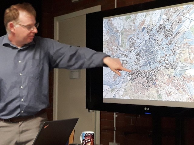
On Thursday we held an evening event at Burnage Library with Dr Martin Dodge from the University of Manchester Geography Department talking on “100 Complicated Years of Municipal Housing in Manchester”. A full house turned out to hear Martin, co-author of Manchester: Mapping the City present the story of municipal housing accompanied by a selection of amazing maps and archive images, illustrating how Manchester’s rapid and unplanned growth necessitated an alternative to the crowded, unhealthy dwellings that housed its working people.

Taking us from the first Tenement dwellings on Oldham Road, through the early initiatives of the Blackely Estates and the cooperatively developed Burnage Garden Village, the vision and the acheivements of Wythenshawe in supplying high quality housing in large volumes, Martin took us through to the era of the first clearance and regeneration of Hulme and East Manchester and the relocation of Manchester residents to the remote “overspill” estates, like Hattersley and Glossop.

Members of the audience shared their lived experiences of municipal housing in Hulme, Wythenshawe and Burnage and what they felt was both successful and deeply unpopular about the housing and its influence on the way neighbourhoods thrived or floundered.
Its been great for volunteers and local people from the Burnage community to connect with specialists from Manchester University and we hope that these collaborations will develop new links and opportunities which can also benefit University staff and their students. We’re fortunate to be hosting Dr. Martin Dodge and Dr. Ali Ronan’s exhibition on Burnage Garden Village in our Community Library, plans are afoot for future Map Library visits, and MSc Geographical Information Science student Morgan is keen to work with our group to test an interactive georeferenced Map project.


